
-150x150h.png)


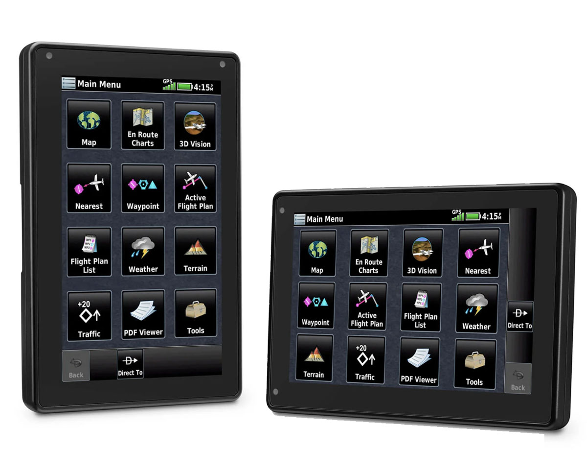
Garmin Aera 760 Portable GPS


Garmin Aera 760 Portable GPS
NZ$3,231.76
Ex Tax: NZ$2,810.22
- Availability: In Stock
- Part Number: 010-02303-02
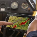
ADVANCED PORTABLE AVIATION NAVIGATION WITH A 7-INCH DISPLAY
Fly confidently with Garmin's rugged, reliable, purpose-built GPS for flight – including IFR approaches, arrivals and departures.
- Bright days are no problem — with our vivid, sunlight-readable touchscreen display.
- View VFR sectionals, IFR enroute charts, SafeTaxi® diagrams, airport information and more.
- Be aware down low with terrain alerting and WireAware™ wire-strike avoidance technology.
- ADS-B traffic? Just pair with your compatible transponder or datalink
- Stay ready for flight with database downloads with Wi-Fi® technology.
- Get up to 4 hours of battery life on each charge.
 |
 |
 |
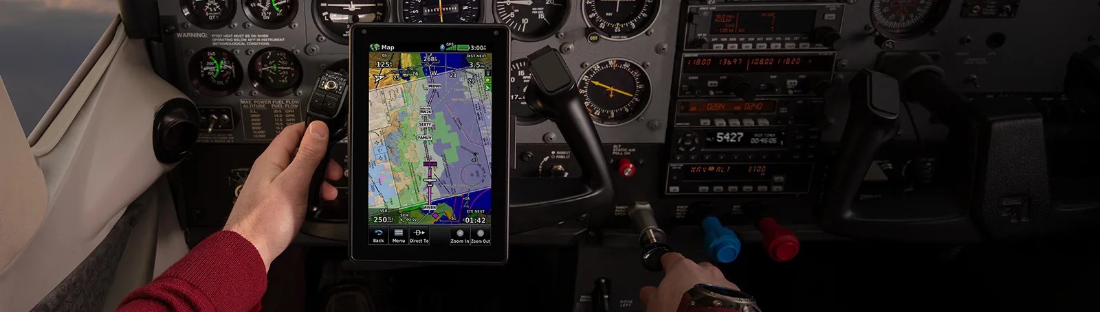
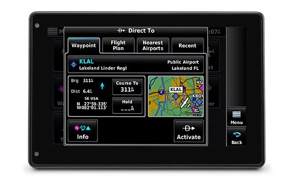
| DIRECT-TO NAVIGATION A Direct-to key on the screen lets you quickly enter a direct course for any selected waypoint. A menu of nearest airports and flight plan waypoints makes for easy entry. |
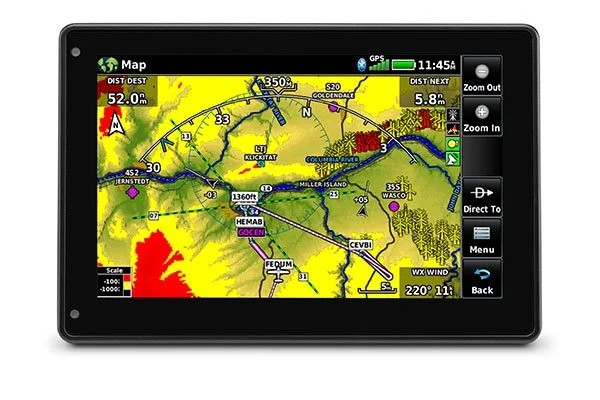
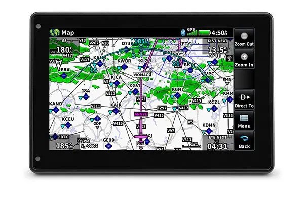
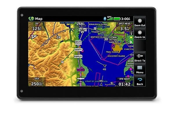
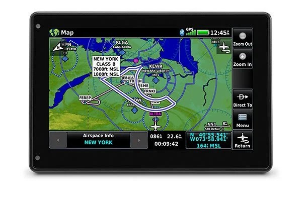
MAP TOPOGRAPHY View ground references — including airports, cities, terrain, obstacles and more — on the dynamic map display to easily determine your position on VFR flights. |
VFR SECTIONAL CHARTS View georeferenced VFR sectional charts for the U.S., Canada and Europe. |
 |
 |
 |
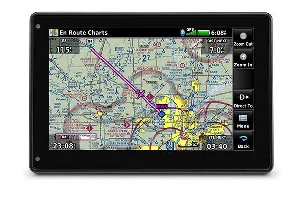
| IFR ENROUTE CHARTS Use IFR map mode to display and navigate on high or low enroute airways. Touch to view minimum enroute altitudes and distances between intersections. |
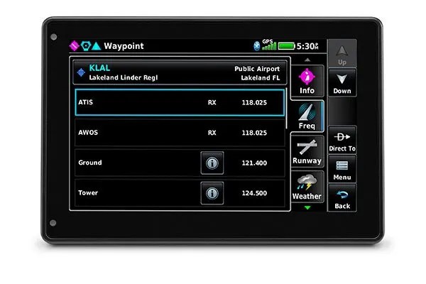
COMM CONNECTION With an optional power/data cable, you can find and upload frequencies to select radios, including most of our GTR™ series COMM radios, GNC® series NAV/COMM radios and more. |
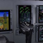
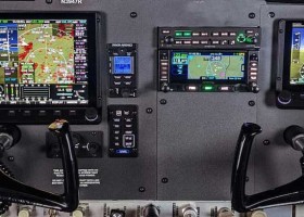
COCKPIT INTEGRATION Interface the aera 760 navigator with the GFC™ 500 digital autopilot for coupled lateral and VFR vertical guidance, and transfer flight plans wirelessly to select Garmin systems. |
 |
 |
|
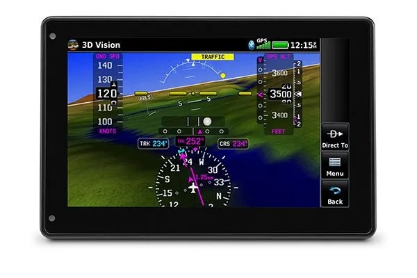
| TARGETTREND™ TRACKING Patented TargetTrend relative motion tracking on aera 760 gives pilots faster, more intuitive ways to judge traffic closure rates and trajectories — so you can identify the greatest threat. |
SMART AIRSPACE™ FEATURE Our patented Smart Airspace guidance highlights the airspace nearest your current altitude so you can quickly identify your location relative to the airspace around you. |
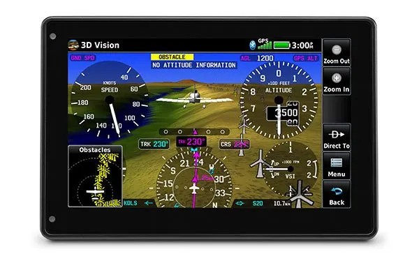
3D VISION 3D Vision technology gives you a virtual 3D behind-the-aircraft perspective view of surrounding terrain, obstacles and airports as well as traffic (when equipped with ADS-B “In”). |
 |
 |
 |
| SYNTHETIC VISION View SVX™ synthetic vision by panel-mounting your aera 760 and using its built-in AHRS or by connecting it to another device with an AHRS, such as a GDL 52 series datalink. |
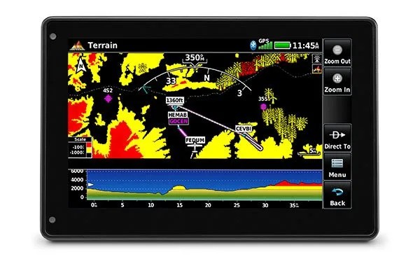
TERRAIN ALERTING See your position above terrain and obstacles on the map and profile view. Obstacles within 1,000’ (or a pilot-customizable height) are highlighted yellow, while obstacles within 100’ are highlighted red. |
SCREEN ORIENTATION Display Rotation Portrait <-> Landscape to suit your needs. |


")

